01
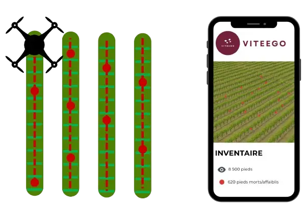
At the beginning of the season, VITEEGO performs a vineyard inventory by drone to map every vine and reveal missing or dead plants. A second flight can then be carried out to detect unproductive plants and ensure proper recovery of replants, for complete vineyard monitoring. Successive mappings allow analysis of vigor, identification of weak plants and planning their replacement via our RTK field application. Each row is numbered and modeled as vectors, providing clear, precise and lasting monitoring of your plots.
02
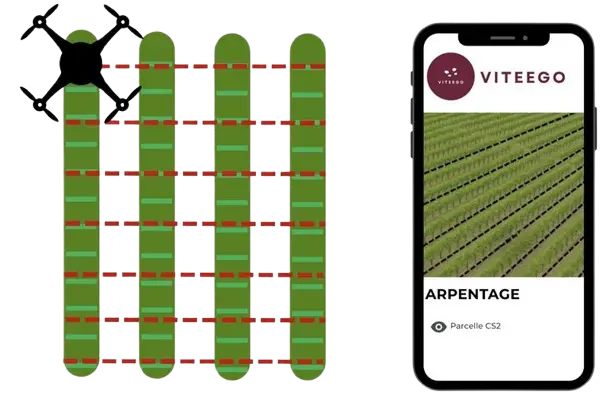
Our drones map your plots automatically using high-definition cameras. The data, processed on our servers, is exported to files compatible with all robots, tractors or mechanized spraying systems. An ideal solution to support viticulture modernization and prepare for the future of robotization.
03
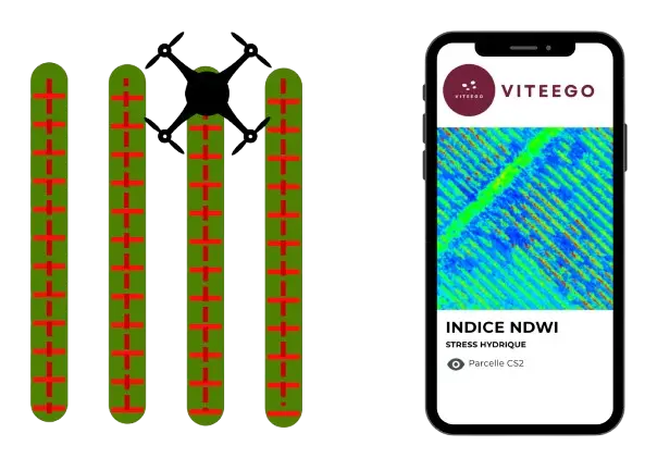
The analysis is performed during the full growth period, over two flights, one in June and another in August, to obtain a faithful vision of vine evolution. Thanks to an exclusive algorithm, VITEEGO distinguishes vine from soil, even grass-covered, to produce a refined and smoothed NDVI index with 25 mm resolution. The refined and smoothed NDVI index reveals intra-plot heterogeneity and allows each intervention to be adapted with precision. We also produce thermal maps and water stress indices to ensure complete monitoring of vegetative potential.
Contact us today for a vineyard inventory by drone
or a customized study of your plots.