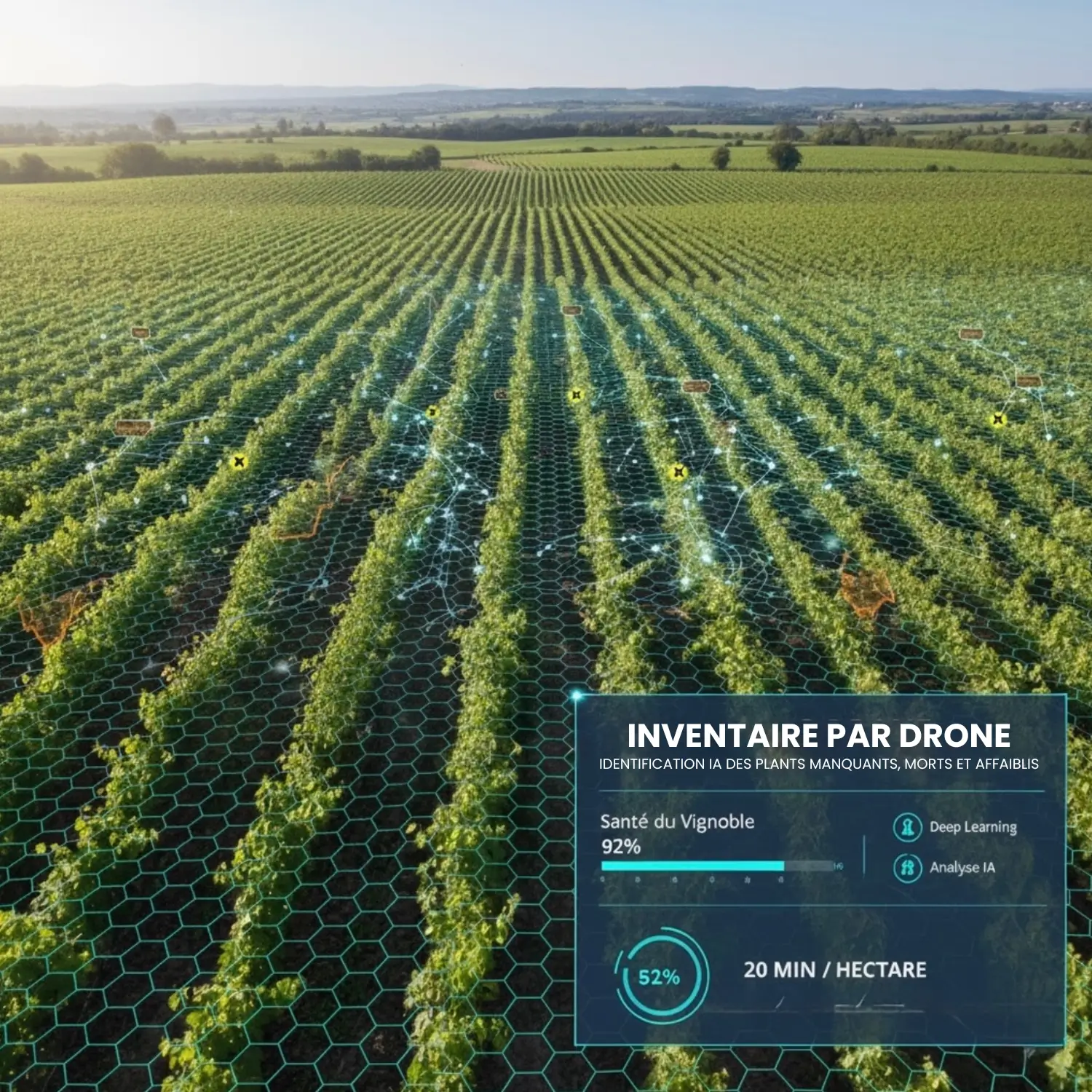
Using drone inventory, quickly identify missing, dead, unproductive or weakened plants through multispectral deep learning and AI. Get a complete overview of your vineyard’s condition in just 20 minutes per hectare.
A valuable tool for planning plant replacement, maintaining homogeneity and preserving production potential.

Topographic survey with ± 0.5 cm precision to model rows and plots with rigor impossible to achieve manually.
Surveyed plots are accessible on an online platform, and the resulting data is compatible with all types of tractors, robots and GPS systems.
The ideal solution to save time, reduce errors through centimeter precision and optimize machine guidance.
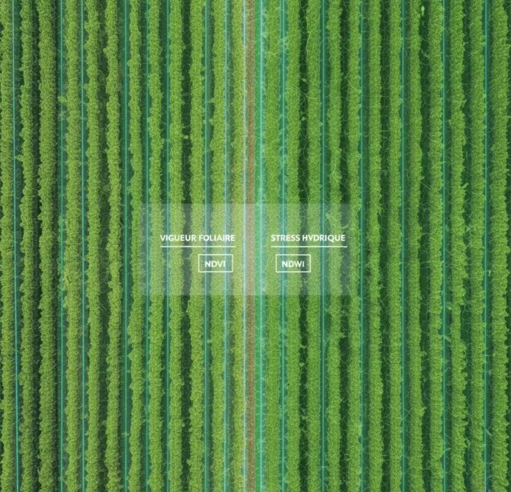
Our mapping reveals what the eye cannot see: vine vigor, water stress, problem areas.
This key information allows you to adjust treatments, target interventions and anticipate upcoming work.
A valuable tool to secure yields and improve grape quality.